Buscar
Monthly semi-distributed hydrological model at national scale in Peru
(European Geosciences Union, 2020)
Surface water resources in Peru are heterogeneously distributed in three drainage areas (Pacific, Titicaca, and Atlantic), and their quantification is relevant for planning in economic activities such as water supply and ...
Acceso abierto
A new climate and glacier baseline for the Cordillera Vilcanota, Peru, reduces critical information gaps
(American Geophysical Union, 2013)
The Cordillera Vilcanota in the Southern Peruvian Andes is the second largest ice-covered Cordillera in Peru (after the Cordillera Blanca) and serves for the Cusco Region as a temporary water storage for fresh-water and ...
Acceso abierto
Monitoring glacier variations in the Urubamba and Vilcabamba Mountain Ranges, Peru, using “Landsat 5” images
(American Geophysical Union, 2013)
The Urubamba and Vilcabamba mountain ranges are two geological structures belonging to the Andes in the southern part of Peru, which is located in the tropical region. These mountain ranges are especially located within ...
Acceso abierto
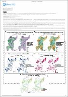
Studying spatial agreement of catchment response to climate and landuse change under uncertainty for prioritizing investment into hydropower catchments
(European Geosciences Union, 2022-04)
Joint climate and land cover change can significantly alter catchment hydrologic response, e.g., in terms of runoff and sediment delivery, and thus key determinants for downstream hydropower outcomes. While many studies ...
Acceso abierto
Participatory rainfall monitoring: strengthening hydrometeorological risk management and community resilience in Peru
(European Geosciences Union, 2022)
Heavy rainfall, floods and debris flow on the Rimac river watershed are recurring events that impact Peruvian people in vulnerable situations.There are few historical records, in terms of hydrometeorological variables, ...
Acceso abierto
Relevance of future snowfall level height in the Peruvian Andes for glacier loss in the 21st century under different emission scenarios
(American Geophysical Union, 2017)
In many regions of Peru, the competition for limited hydrological resources already represents a large risk for conflicts. In this context, and within the circumstances of climate change, there is a great interest in ...
Acceso abierto
Future runoff from glacierized catchments in the Central Andes could substantially decrease
(American Geophysical Union, 2016-04)
In Peru, about 50% of the energy is produced from hydropower plants. An important amount of this energy is produced with water from glaciated catchments. In these catchments river streamflow is furthermore needed for other ...
Acceso abierto
Snow-Hydrological modeling using remote sensing data in Vilcanota basin
(European Geosciences Union, 2020)
Water resources availability in the southern Andes of Peru is being affected by glacier and snow retreat. This problem is already perceived in the Vilcanota river basin, where hydro-climatological information is scarce. ...
Acceso abierto
Air temperature, radiation budget and area changes of Quisoquipina glacier in the Cordillera Vilcanota (Peru)
(American Geophysical Union, 2015)
The Peruvian Andes host about 71% of all tropical glaciers. Although several studies have focused on glaciers of the largest glaciered mountain range (Cordillera Blanca), other regions have received little attention to ...
Acceso abierto
The Relationship Between Shallap Glacier - Cordillera Blanca and King George Island - Antarctic Peninsula
(American Geophysical Union, 2021-12)
The main goal of this study is to determine the relationship between Shallap Glacier (SG) — Cordillera Blanca and King George Island (KGI) glaciers — Antarctic Peninsula and describe their features. Multi-temporal analysis ...
Acceso abierto


