


Buscar

ICE Thickness Using Ground Penetrating Radar at Znosko Glacier on King George Island
(Institute of Electrical and Electronics Engineers Inc., 2020-08-12)
Ground Penetrating Radar (GPR) survey was carried out to estimate the ice thickness and mapping the bedrock topography at Znosko glacier on King George Island, Antarctic Peninsula during 25 th Peruvian Antarctic Expedition ...
Acceso restringido
Mass balance study of the Znosko glacier, Antarctica, using remote sensing and in situ measurements
(European Geosciences Union, 2021-03)
Glaciers are a key indicator of climate change. Since the second half of the 20th century several glaciers in Antarctica have retreated. In situ measurements of glacier mass balance in the Antarctic Peninsula and its ...
Acceso abierto
Influence of Climate Variability in King George Island Glacier Retreat – Antarctic Peninsula
(European Geosciences Union, 2021)
This research aims to explain the influence of climatic variables (temperature and precipitation) in King George Island (KGI) glacier shrinkage on the Antarctic Peninsula. It employed Landsat satellite images from 1989 to ...
Acceso abierto
The Relationship Between Shallap Glacier - Cordillera Blanca and King George Island - Antarctic Peninsula
(American Geophysical Union, 2021-12)
The main goal of this study is to determine the relationship between Shallap Glacier (SG) — Cordillera Blanca and King George Island (KGI) glaciers — Antarctic Peninsula and describe their features. Multi-temporal analysis ...
Acceso abierto
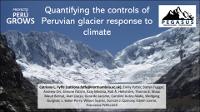
Quantifying the controls of Peruvian glacier response to climate
(American Geophysical Union, 2021-04)
Peruvian glaciers are important contributors to dry season runoff for agriculture and hydropower, but they are at risk of disappearing due to climate warming. Their energy balance and ablation characteristics have previously ...
Acceso abierto
Implementation of a flood forecasting system in a transboundary river basin, Peru – Ecuador
(European Geosciences Union, 2020)
The Peruvian Service of Meteorology and Hydrology (SENAMHI) provides hydro-climatological hazard information to population and decision-makers about flood forecasting and warning on the whole territory of Peru. For flash ...
Acceso abierto