


Buscar

ICE Thickness Using Ground Penetrating Radar at Znosko Glacier on King George Island
(Institute of Electrical and Electronics Engineers Inc., 2020-08-12)
Ground Penetrating Radar (GPR) survey was carried out to estimate the ice thickness and mapping the bedrock topography at Znosko glacier on King George Island, Antarctic Peninsula during 25 th Peruvian Antarctic Expedition ...
Acceso restringido
Climate change impacts on biomes and aridity in Peru
(European Geosciences Union, 2020-06-12)
The preliminary results showed that random forest worked best for the PB imbalanced data, having a 0.84 weighted average in precision and recall metric. The model reproduces 9 of the PB with low error 4.5% and overestimates ...
Acceso abierto

Analysis of remote sensing and in situ datasets to estimate spatial precipitation in high mountain areas: case study Cordillera Blanca, Peru
(European Geosciences Union, 2021-01)
This study focused on estimating precipitation for the Santa basin located north of the capital of Peru, assessing spatial patterns and temporal variation. Precipitation products were used at a daily temporal resolution ...
Acceso abierto
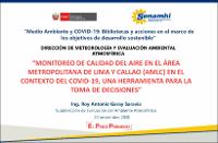
Monitoreo de calidad del aire en el Área Metropolitana de Lima y Callao (AMLC) en el contexto del covid-19, una herramienta para la toma de decisiones
(Servicio Nacional de Meteorología e Hidrología del Perú, 2020-11)
Explica la calidad del aire en el Área Metropolitana de Lima y Callao (AMLC) durante el estado de emergencia, y sostiene que las concentraciones de contaminantes particulados PM10 mostró una disminución para el mes de marzo ...
Acceso abierto
Using open source & low cost rain gauges to support debris flow real-time monitoring in Lima, Peru
(European Geosciences Union, 2021-01)
Debris flow, locally known as huaycos, impact the east part of the metropolitan city of Lima, capital of Peru. However, after many extreme events such as the one related to the 2017 “Coastal Niño” or the one in 1987, there ...
Acceso abierto
The vulnerability of water availability in Peru due to climate change: A probabilistic Budyko analysis
(European Geosciences Union, 2020)
This study provides for the-first-time a water availability analysis at drainage and basin-scale in Peru. Using new gridded datasets of precipitation and temperature, along with six global actual evapotranspiration estimations ...
Acceso abierto
Monthly semi-distributed hydrological model at national scale in Peru
(European Geosciences Union, 2020)
Surface water resources in Peru are heterogeneously distributed in three drainage areas (Pacific, Titicaca, and Atlantic), and their quantification is relevant for planning in economic activities such as water supply and ...
Acceso abierto
Effects of the use of the BAKE mobile application as an Educative instrument for teaching content for preschool education to Shipibo people in the community of Cantagallo, Lima, Peru
(Institute of Electrical and Electronics Engineers Inc., 2020-03)
This document includes the experience in the design, development and validation of a mobile application conceptualized as an instrument for basic teaching and self-learning of the Shipibo - Konibo language. It was created ...
Acceso abierto
Surface water resources assessment in Peru through SWAT hydrological model
(European Geosciences Union, 2020)
Surface water resources in Peru show high spatio-temporal variability, being the prediction of streamflow at ungauged sites, one of the fundamental challenges today. This research presents a methodology for regional ...
Acceso abierto
Mass balance study of the Znosko glacier, Antarctica, using remote sensing and in situ measurements
(European Geosciences Union, 2021-03)
Glaciers are a key indicator of climate change. Since the second half of the 20th century several glaciers in Antarctica have retreated. In situ measurements of glacier mass balance in the Antarctic Peninsula and its ...
Acceso abierto